Roman Tmetuchl International Airport (Roman Tmetuchl International Airport)
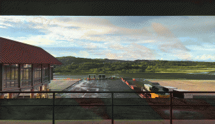
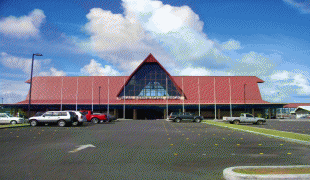
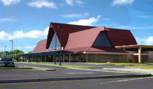
Roman Tmetuchl International Airport, also known as Palau International Airport is the main airport of Palau. It is located near the former capital Koror, just north of Ngetkib, Airai on Babeldaob island. The airport is 4 miles (6 km) from Koror and 15 miles (25 km) from Ngerulmud.
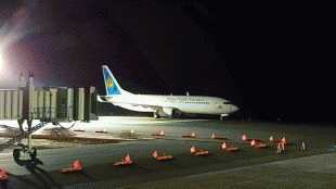
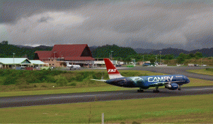
The airport covers an area of 480 acre at an elevation of 176 feet (54 m) above mean sea level. It has one runway designated 9/27 with an asphalt and concrete surface measuring 7,200 by 150 feet (2,194 x 45 m). For the 12-month period ending December 13, 2004, the airport had 1,142 aircraft operations, an average of 95 per month: 78% scheduled commercial, 10% air taxi, 8% general aviation and 4% military.
The airport covers an area of 480 acre at an elevation of 176 feet (54 m) above mean sea level. It has one runway designated 9/27 with an asphalt and concrete surface measuring 7,200 by 150 feet (2,194 x 45 m). For the 12-month period ending December 13, 2004, the airport had 1,142 aircraft operations, an average of 95 per month: 78% scheduled commercial, 10% air taxi, 8% general aviation and 4% military.
| IATA Code | ROR | ICAO Code | PTRO | FAA Code | |
|---|---|---|---|---|---|
| Telephone | Fax | ||||
| Home page |
Map - Roman Tmetuchl International Airport (Roman Tmetuchl International Airport)
Map


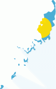


Country - Palau
 |
 |
| Flag of Palau | |
The country was originally settled approximately 3,000 years ago by migrants from Maritime Southeast Asia. Palau was first drawn on a European map by the German missionary Paul Klein based on a description given by a group of Palauans shipwrecked on the Philippine coast on Samar. Palau islands were made part of the Spanish East Indies in 1885. Following Spain's defeat in the Spanish–American War in 1898, the islands were sold to Germany in 1899 under the terms of the German–Spanish Treaty, where they were administered as part of German New Guinea. After World War I, the islands were made a part of the Japanese-ruled South Seas Mandate by the League of Nations. During World War II, skirmishes, including the major Battle of Peleliu, were fought between American and Japanese troops as part of the Mariana and Palau Islands campaign. Along with other Pacific Islands, Palau was made a part of the United States-governed Trust Territory of the Pacific Islands in 1947. Having voted in a referendum against joining the Federated States of Micronesia in 1978, the islands gained full sovereignty in 1994 under a Compact of Free Association with the United States.
Currency / Language
| ISO | Currency | Symbol | Significant figures |
|---|---|---|---|
| USD | United States dollar | $ | 2 |
| ISO | Language |
|---|---|
| ZH | Chinese language |
| EN | English language |
| JA | Japanese language |